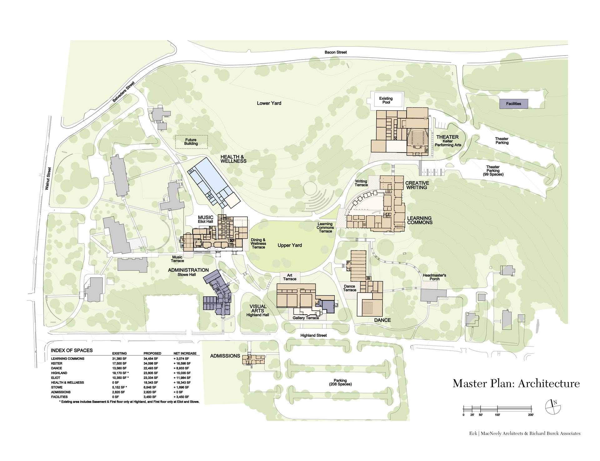
Eck MacNeely Architects were brought on to develop a master plan to depicts the current conditions of the Walnut Hill School campus. Of primary concern are the patterns of circulation running through the campus. Pedestrians crossing from Eliot Hall to the Academic and Technology Center where no path exists was observed as well as pedestrian/service area conflicts behind Eliot Hall. Another concern addressed by faculty and students of WHS is the lack of outdoor gathering spaces on campus.
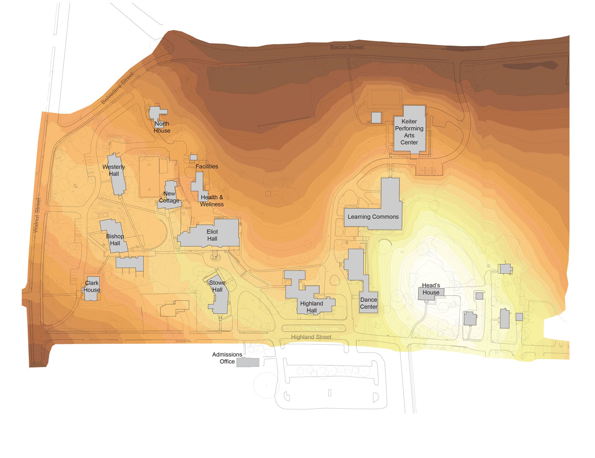
The existing topography plan (shown on slide 4 below) indicates the dramatic topographic nature of the site. While this created challenges in establishing site connections, flat open space, and accessibility, there were great opportunities for impressive views and experiences throughout the campus. Existing topographic challenges also included considering stormwater runoff and water pooling at low points along Bacon Street.
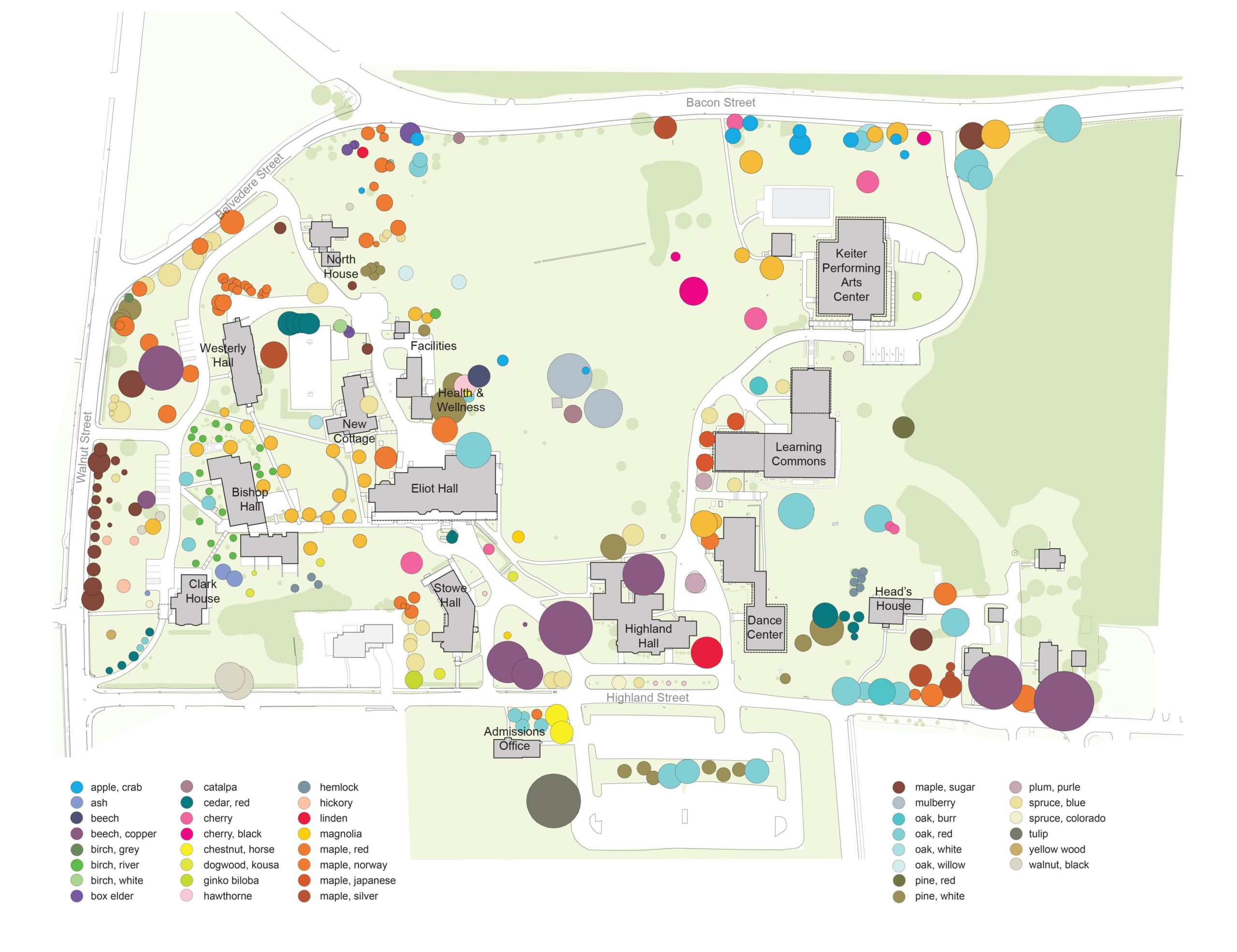
The species of existing trees across the Walnut Hill School campus were also surveyed for this plan. Over 37 different species of canopy and understory trees were identified, many of which, including the prolific Norway Maple, are invasive. Signature trees include the European Beech at Stowe Circle and the line of sugar maples along Walnut Street. The great variety of tree species posed a challenge in establishing a cohesive campus identity through campus design.
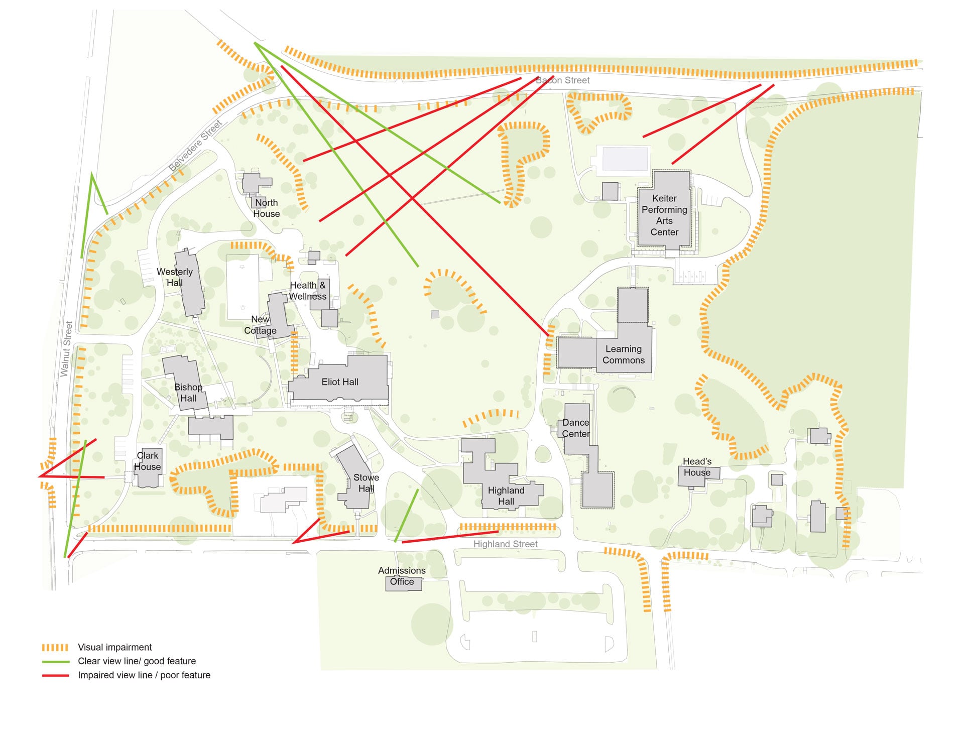
Existing views, as well as view impairments, were identified for this master plan. Poorly placed trees and unsightly topographic features blocked line of sight to many of the most important campus elements, including the views from Bacon Street towards the campus interior. Alternatively, campus elements that should not be highlighted, such as the service entry of Keiter Theater, are prominently displayed and would benefit from a thoughtful plant screening.
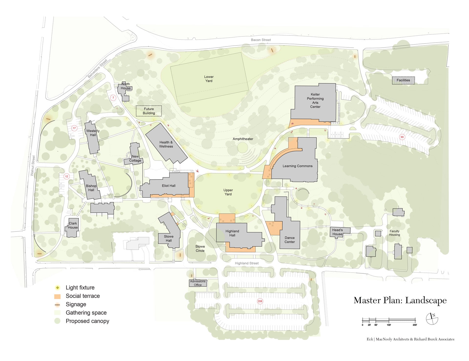
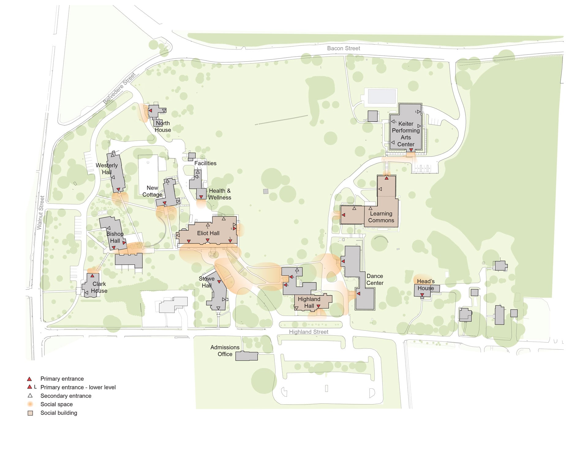
In identifying important “community buildings” and understanding site topography and viewsheds, key social spaces were identified on campus (see slide 7 above). These spaces are often the sites of informal meeting and gatherings and should support the presence of a number of pedestrians. As indicated in this analytical plan, existing social spaces were disconnected from one another, with the most significant common space on campus being a high vehicular and pedestrian traffic area between Eliot, Stowe and Highland Halls. The Academic and Technology Center, a major social building for students and faculty, is devoid of outdoor social space and cut off from the common spaces of other social buildings.